Before I continue, I should mention that we spent most of our time yesterday with our heavily-loaded bikes pointed South, into an 18-25 MPH headwind. Keep that in mind as you read this.
It wasn't exactly an S24O trip. I left at 8 in the morning to ride to church yesterday, since it's close to the Price Chopper. Locked up at church: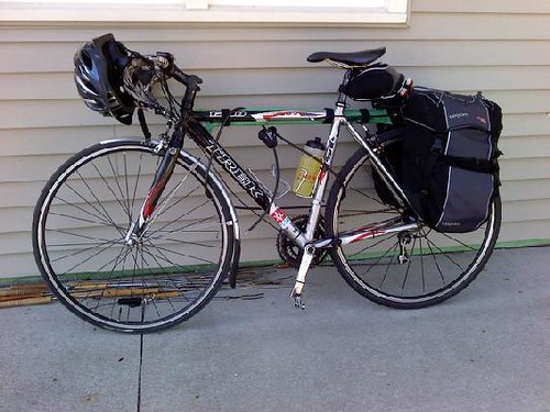
At about noon, though, I left for Price Chopper, went inside and scored a quick lunch at the deli. Shortly thereafter, Randy pulled up. Randy wasn't going to be able to camp with us, but he's going on a week-long bike tour soon and wanted to shake down his new gear, namely his front rack and pannier setup. His plan was to ride to Hillsdale Lake with us then return home. Soon, commuterDude showed up. This was who RSVPd. It'd be a small group, but it would afford us a lot of flexibility on route, schedule and whatnot.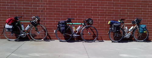
I recalled a shortcut through Spring Hill that Randy showed me last time we went out this way, and asked him to take us along a similar route outbound. We'd end up taking Ridgeview to 207th, then west to Woodland, before winding through some residential stuff to get through Spring Hill. We'd barely touch the main drag through town (Webster) before hopping on Victory Road, which turns to gravel just south of town.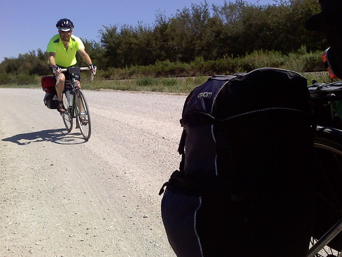
Victory doesn't cut all the way through, though. The first time I did this S24O, I made a quick stop by the railroad bridge on 239th which was about 1/8 mile out of the way, then went West on 239th. Our group stopped for a quick break in the shade by the bridge.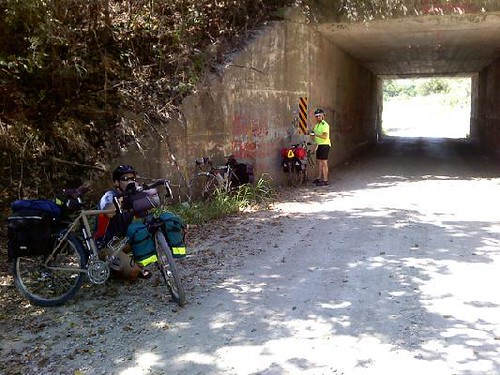
Overhead, we heard something. We thought it may have been a railroad maintenance truck. It certainly wasn't a train. We walked up to see what was above the bridge. Lo and behold, there was an un-used railbed alongside the existing track. We may have heard a four-wheeler, for all I know. At first glance, this railbed looked a bit like a rails-to-trails path, maybe a bit rougher. We decided to go for it. We took a little access road to get to it, and didn't see any signs or gates stating we couldn't use it. Randy is using a Long Haul Trucker with 1.95" tires. He's The Dirt Bum, for crying out loud. He does this all the time. cDude and I, though, were quickly descending into a habit of pushing the limits of our bikes. Modern bicycle marketing being what it is, we were using "the wrong kind of bike" for this stuff. It's not so apparent in this photo, but as we got further south, we'd encounter track ballast on the railbed, made of large chunks of flint, slate and limestone. Our skinny little tires would wobble hither to yon, searching for solid ground below the boulders as our high-pressure road tires launched some of the smaller rocks out like bullets with god-awful noises. Ping! Thwack!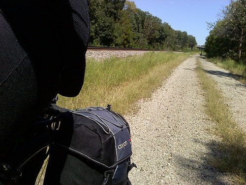
After a few miles, we ended up at a dead-end railroad crossing near Columbia Rd. No idea what it was there for, but we crossed the tracks and hit more gravel.
There was an interesting abandoned bridge just off Columbia Rd that appears to be a historic bridge for the same road from God-knows-how-long-ago.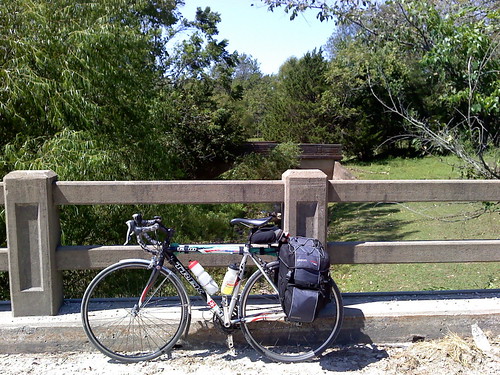
A little better picture of it, but I should have backtracked up the road a bit to get a better shot.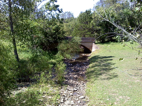
We continued south to get to 255th St in the heart of old downtown Hillsdale Kansas. We'd stop at the convenience store to fill our bottles up, and that's when "Underbiking" happened.
Usually, we'd head west to the lake, but we continued south on Hedge Lane (old KC Road) and found more gravel on 271st. We rode that out to Woodland Rd, which featured some not-so-subtle hills. In these parts, there are maybe 20 people who have any legitimate need to use the road. It's all farmland.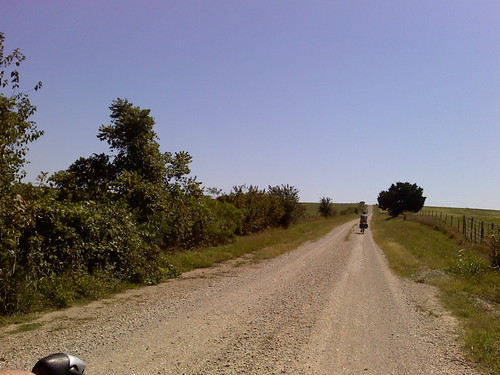
Once we got to 287th street, Woodland ostensibly ended with a "Minimum Maintenance Required" sign. As cDude put it, "Their idea of maintenance was to put that sign up a long time ago and forget about it." - I'm paraphrasing a bit, probably, but however it is he said it, I couldn't have put it any better.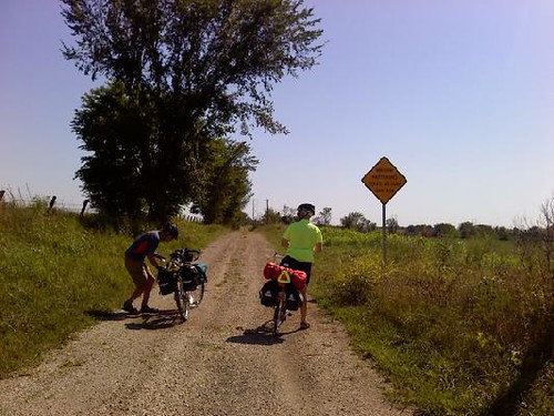
I didn't get any pictures of the sloppier parts of this road. It continues on for about a mile, and parts of woodland are impassable for any 4-wheel vehicle not purpose-built for mudbogging. We, on our trusty two-wheel steeds were able to navigate around the behemoth mud puddles, but both cDude and I found ourselves stopping a few times to clear mud out of our fenders and low-clearance road brake calipers. 3 or 4 times, my own bike completely clogged up and neither front nor rear wheel would spin at all. The muddy trail turned west, placing us on a ruttier and rockier section of "road" that is supposed to be 295th St. These vestigial roads have long out-lived their usefulness. They go nowhere and are needed by no one. They're enjoyed by off-roaders of all types, though. Yesterday, that was us. We'd hit Victory road, where suddenly the gravel was even again. After the previous section, it might as well have been the Bonneville Salt Flats for all I was concerned.
We veered south to 299th St and went west, crossing the southern dam of Miola lake, where lots of people were enjoying the long weekend. I was already completely out of water and had borrowed a bottle from cDude. We stopped at an RV station and used their drinking water refill nozzle to refill our bottles and hose our bikes off to clear out enough of the clay mud from our brakes and fenders to allow our wheels to spin freely again. I was also burning up and covered in salty sweat crystals. I took the liberty of hosing myself down with the nozzle. Might as well, right? I think Randy got a picture of that.
We hopped over to Hedge lane, then weaved our way through various rural byways and another stretch of minimum-maintenance stuff that doesn't even show up on a map, featuring a weathered, repeatedly repaired creek bridge that's obviously failed more than once under the weight of crossing vehicles. My wheels clogged once more, and we finally made it to Lake Rd, where the entrance to Hillsdale State Park was waiting for us. Randy parted ways, while cDude and I forged onward to the camp site, where both of us leaned our bikes on the first available lean-worthy structure, and ceremoniously cracked open the beer we brought along. Somehow, his was still cold. My Boulevard Wheat was in a pannier water bottle holder. It was warm and covered in dust, but it was still the best beer I've ever tasted.
My wife showed up to hang out with us at the camp site for a while just as we finished setting up our tents and locking the bikes up. We unloaded a few more cold beers from the cooler, and settled in for supper. Me? Reconstituted freeze dried stuff. Dude made bean burritos. We both used soda-can alcohol stoves.
As night fell, we found some abandoned fire wood to set up. I carved a skewer, and we roasted some marshmallows I'd packed away.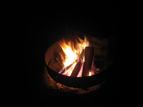
We had some good conversation, cleaned up and hit the sack pretty early. I never touched the fishing gear I packed, and kind of wished I had packed a camp pad in its place to go with my bedroll. Lessons learned for future trips. It didn't bother me much last year, but I must be getting old. This is a 64-second-long exposure of our galaxy's core, as taken with a cheap point-and-shoot camera.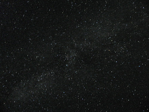
Breakfast was two tylenol, french-pressed coffee and scrambled eggs. cDude fashioned a brew basket out of a PBR can, and used a drip filter and coffee grounds he brought from home. Once coffee was made, he did oatmeal. Why didn't I think of oatmeal?!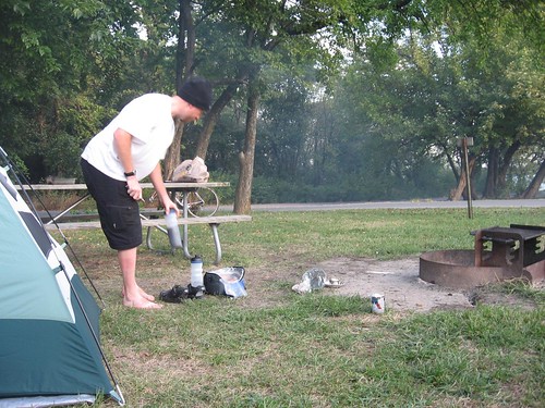
By 9:00, we had everything packed up, and rolled out shortly there after. To say we took a different way home is an understatement! A quick stop by Lake & Dale again, and we bee-lined it home from there. You can still see the clay mud on my tires. I wrapped all of my dirty clothes up in my commute towel and lashed it down. They were muddy and damp, no sense in putting that stuff in my panniers.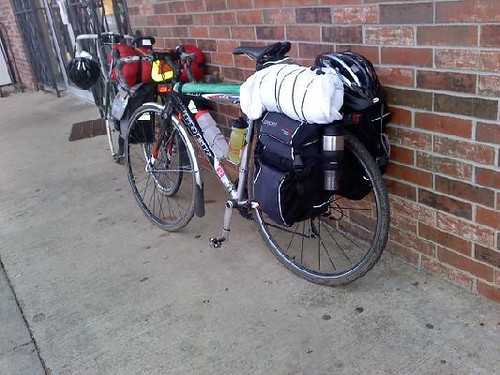
A carbon-riding, camelbak-wearing roadie blasted past us on old KC Road, and I exchanged greetings with him. He was thankful for the tailwind heading north. He got up the road a ways, and I started taking my pull. We had a pretty good clip going, but when I ran out of steam, the race was on. I watched cDude reel the poor guy in. I really wish I could have been there to see the look on his face, being passed by a guy on a loaded steel bike.
I eventually caught up with Keith in Spring Hill. From there, it was an easy ride back with most of the hills behind us and a good push from the south winds. At 159th and Ridgeview, Keith and I bumped fists and parted ways and I continued home, using a good part of my usual commute route.
Stats:
Pack Weight: 27.2 pounds
Distance: 82.8 miles
Elapsed Rolling Time: 7h 17m 14s
Average speed: 11.36 MPH
Max speed: 28.1 MPH
Monday, September 06, 2010
Off-roading, Bike camping
Subscribe to:
Post Comments (Atom)

6 comments:
It looks like an absolute blast! It's very cool to see three bike blog folks connecting for a ride like this.
I always bring oatmeal on camping trips. It's perfect ... small, easy to carry, lightweight, easy to cook, but also filling. Also I forgo my usual coffee in favor of tea because it's so much easier.
Epic. I want in next time. Sorry I missed it.
Good job on the Milky way pic!
The Tylenol breakfast of champions huh? Nice.
This is my first summer without doing a tour. I feel like a recovered something or other.
Cool Milky Way photo! You can do some post-production stuff to really make it pop. What kind of point and shoot camera do you use that lets you take that long of an exposure? Mine only lets me do 15 seconds.
Here's the best point and shoot Milky Way photo I could take.
I have a Canon PowerShot A530, but the crux is CHDK, a piece of open-source firmware for certain low-end Canon cameras that unlocks all kinds of potential. I documented how to use it in combination with some other pieces of freeware to do HDR (even though I'm not much of a fan of HDR) http://www.h-i-r.net/2008/11/open-source-hdr-photography-with-chdk.html
Post a Comment